3D laser scanning is an advanced technique that can help you collect millions of valuable data in a very short time without compromising on work efficiency and accuracy of figures. Thus, 3D laser scanners qualify as a high-definition system for surveying lands and help to save your money and time.
3D Laser Scanning and Its Usage:
3D Laser Scanning and Its Usage:
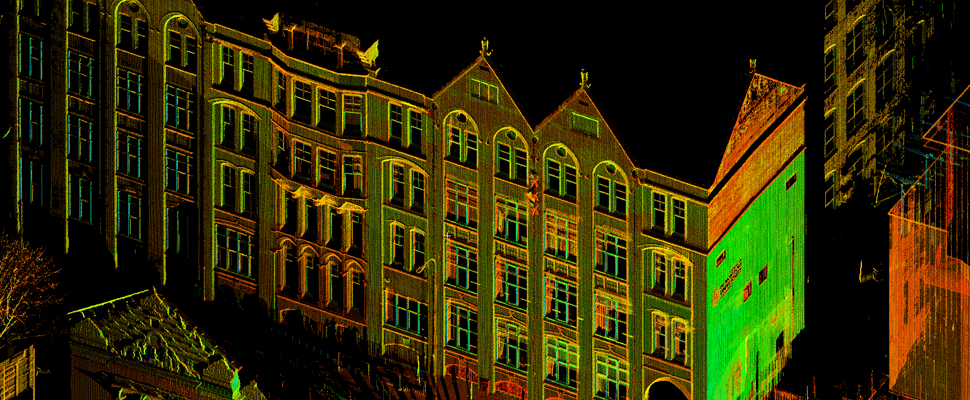
3D laser scanning technology helps to gain survey information as well as assists with the construction and design of buildings. High-speed 3D scanners provide life-like images of a required field of work which helps in making well-informed layouts and calculations.
It is used in architecture to superimpose an image with accurate specifications on a landscape to know how the finished project would look like. Other industries where it is used are bridge design, aviation, wastewater plants, transportation, and logistics.
Advantages of 3D Laser Scanning in Land Surveying:
Laser scanners are the most valuable tools used in land surveying. It not only helps to find the issues but also improves their project outcomes and data collection. Here’s how:
1.Adaptability: 3D laser scanners come in an array of various types and platforms, which allows land surveyors to pick the right tool in accordance with their specific job. Be it mobile laser scanning or aerial mapping, different techniques mean different solutions for land surveying professionals.
2.Accurate Data Collection: Since laser scanners have the ability to thoroughly assess spaces, the resulting data collection can be used for creating maps with the help of the latest software. Highly precise models and realistic drawings are some of its key benefits since surveyors use them to showcase the solutions to their clients.
3. Fewer Labour: As it is, there is a shortage of land surveyors. Since laser scanners allow surveyors to take on several projects at once without an overload of work, it helps to reduce the hindrances caused by a labor shortage. The speed and accuracy of 3D laser scanning allow professionals to be more productive as they have to spend a minimal amount of time on each project. It also ensures fewer site visits and reduced rework.
3D laser scanning is a cost-effective, time-saving technique that involves lower overall risk. It helps land surveyors have access to higher precision data and take on a more consultative role with clients.